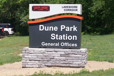
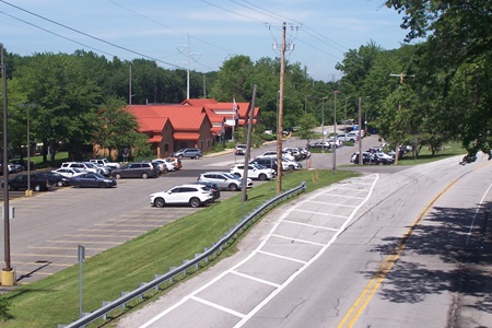
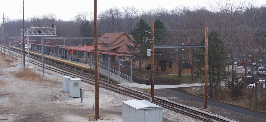
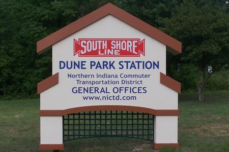
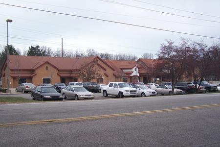
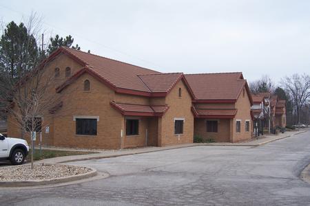
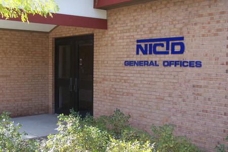
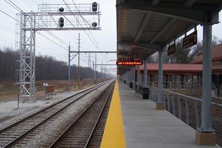
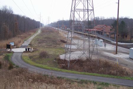
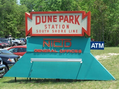
Dune Park StationDune Park Station is located on US 12 just east of SR 49 near the entrance to the Indiana Dunes State Park. SR 49 provides a connection from the park entrance south to US 12, US 20, I 94 in Chesterton, the I 80/90 Toll Road south of Chesterton and further south to Valparaiso and beyond. The Dune Park Station was built in 1985 replacing a stop 3/4 miles east at Tremont Rd (and stop 1/4 mile west at Waverly Rd). The western portion of the station building serves as the general offices for the Northern Indiana Commuter Transportation District (NICTD).The Dune Park Station provides parking for commuters who arrive via US 12 and SR 49 from neighboring communities as well as State Park access via the Dunes-Kankakee Trail. The Calumet Trail paralleling the South Shore Line also connects to the station. 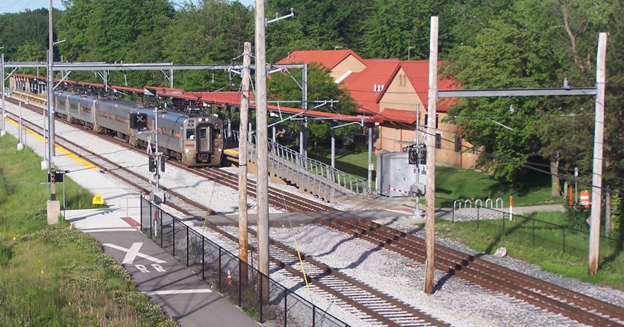 Dune Park Station as seen from the Dunes-Kankakee Trail on the SR 49 overpass bridge. (2024) | |
|
|
|
|
| DOUBLE TRACK NORTHWEST INDIANA CONSTRUCTION | |
Construction has completed. Construction photos are available. | |
| See construction photos on the 2023-24 Double Track NWI Construction page. | |
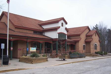
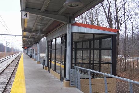
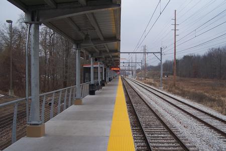
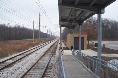
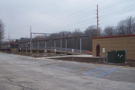
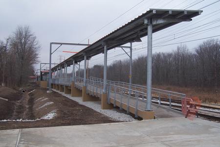
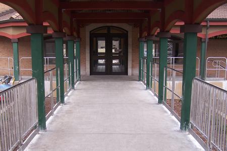
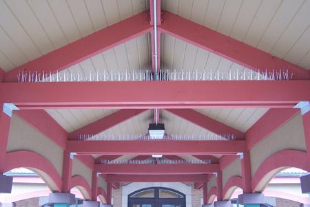
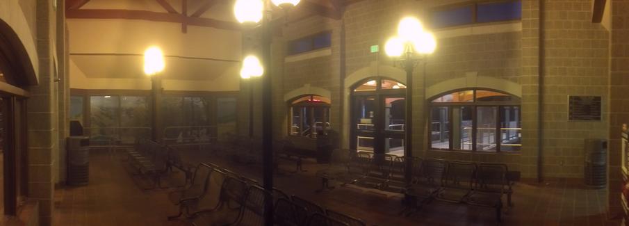
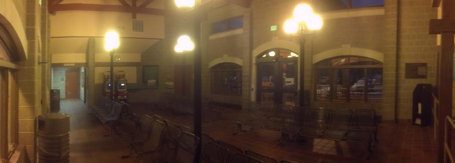
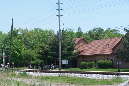
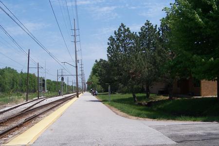
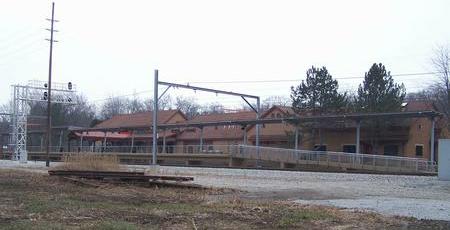
Dune Park 2013 Dune Park Station after construction of a new high level boarding platform completed in 2013. Photos from 2009 are at the bottom of the page. | |
|
|
|
|
|
|
|
|
|
|
|
|
|
|
|
|
|
|
|
|
|
|
 |
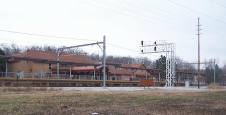 |
Two views of the Dune Park station building as seen from the Calumet Trail. (Dec 2013) | |
| See construction photos on the 2013 Dune Park Construction page. | |
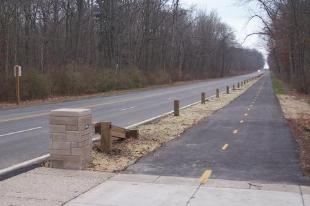
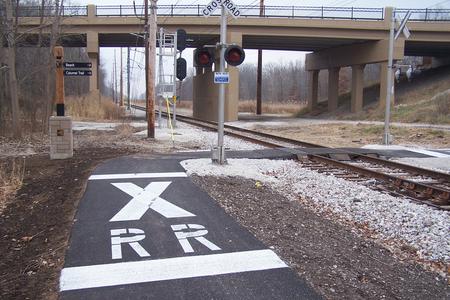
The Calumet Trail and Dunes-Kankakee Trail (December 2013) The crossing has been relocated to the west end of the platform. The photos below show the trail crossing in 2013. |
|
 |
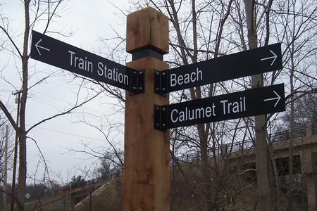 |
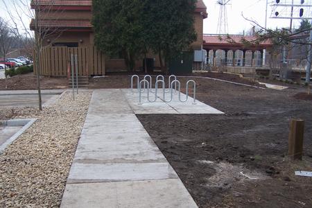
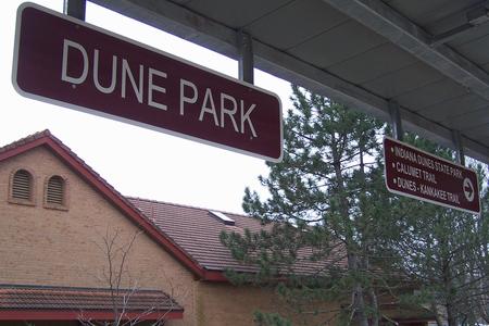
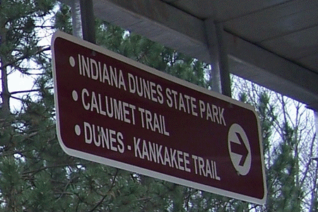
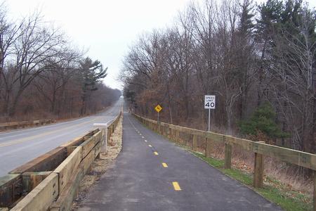
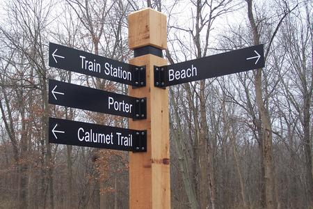
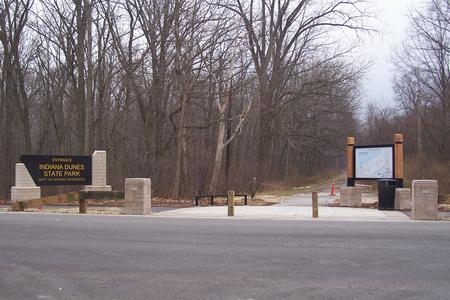
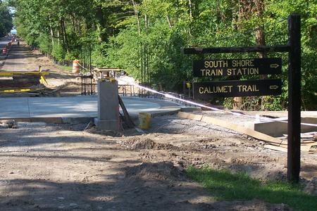
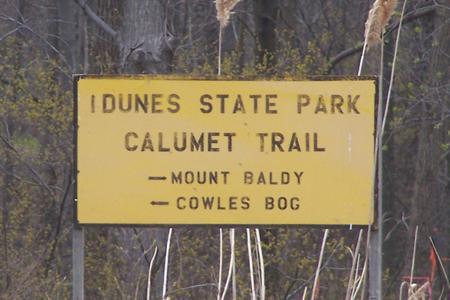
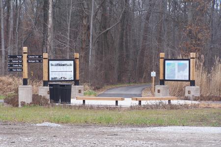
West of Dune Park Station there is a connection to two trails: The Calumet Trail that runs along the South Shore for 9.1 miles and the Dunes-Kankakee Trail under construction between the Indiana Dunes State Park (one mile north) and the Kankakee River on the southern edge of Porter County. Trailheads are at junction points and signs have been posted clearly marking the trail along with popular destinations. A "State Park" sign has been added to the sign above. |
|
 |
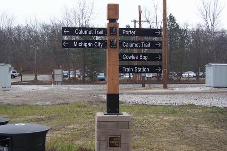 |
The trailhead connecting the Calumet Trail with the Dunes-Kankakee Trail can be seen from the station. The large signs at this trailhead provide a history of the area (left sign) and a map of all area trails (right sign), along with information about trail restrictions. Directional arrows are available to point toward the desired destination. (The signs pointing toward the camera are for the "Beach" and "Visitor Center". "State Park" has also been added.) |
|
|
|
|
|
|
|
|
|
The Calumet Trail is a 9.1 mile county operated trail that runs on the NIPSCO right of way from Mineral Springs Road (about 1.5 mile west of Dune Park Station) eastward to the Porter/LaPorte County Line. There are long term plans to extend this trail east into Michigan City. The western end connects to trails operated by the National Parks Service. The Dunes Kankakee Trail is a new trail that runs from the Indiana Dunes State Park (about 1 mile north of Dune Park Station) south toward Chesterton and Valparaiso. When complete the trail will run all the way to the Kankakee River on the south edge of Porter County. The main trail runs along the east side of SR 49 on the bridge over the South Shore and US 12 with a spur through the woods just north of the South Shore station to connect to the Calumet Trail and the station. The first segment of the Dunes Kankakee Trail opened at the end of 2013. |
|
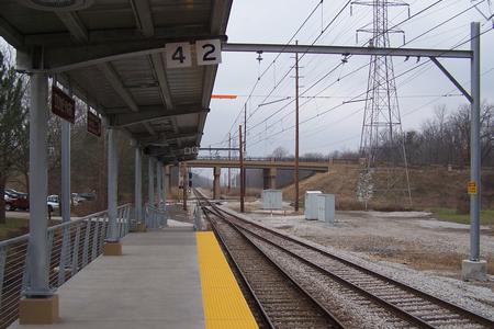
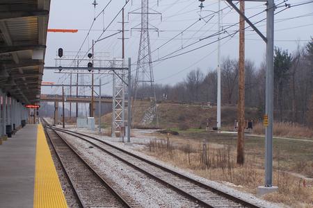
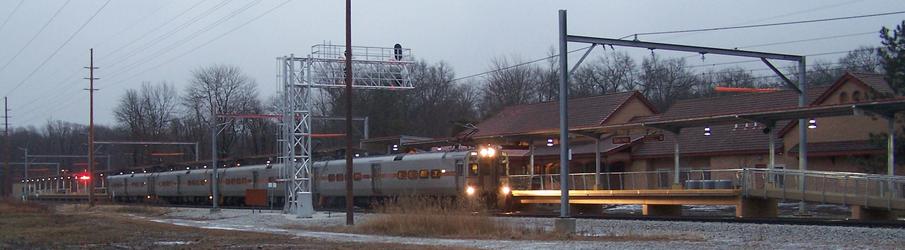
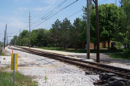
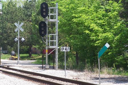
Freight Train Passing (switch removed 2022) To keep freight cars away from the platform edge freight trains were routed to the siding between CP 43.7 and CP 43.0. This route was also used for passenger trains that did not stop at Dune Park (generally out of service trains). As part of the Double Track Northwest Indiana project this switch was removed and a gauntlet was added on track 1 to allow trains to bypass the platform. The siding was upgraded to become main track 2. |
|
|
|
|
|
| (Note: The top two photos were taken from the public pedestrian crossing west of the station platform. The bottom two photos were taken from a temporary public crossing during the construction of the new platform at Dune Park from a public crossing that has since been removed.) | |
| See construction photos on the 2013 Dune Park Construction page. | |
Tremont - Gateway to the Dunes |
|
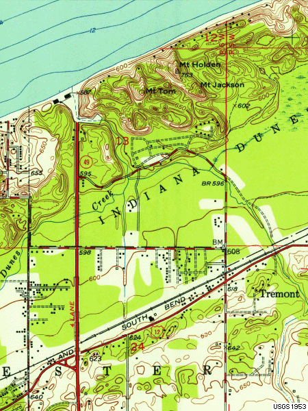 |
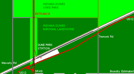
The USGS map to the left shows the Tremont area in 1953. The three mountains (Mt Tom, Mt Holden, Mt Jackson) from which Tremont got its name are located along the lakefront in the Indiana Dunes State Park. In 1837 a village called "City West" was located near what became the main beach area of the state park. The village failed in 1837 and "New City West" took root along the Dunes Highway to the southeast. In the early 1900s the Chicago, Lake Shore & South Bend Railway platted what became the CSS&SB railroad through the area and in 1908 "Tremont" was born. The Indiana Dunes State Park opened in 1926. Combined with the beginning of the Samuel Insull Era for the railroad Tremont became a tourist destination for passengers from the cities of Chicago and South Bend visiting the dunes. The CSS&SB station building was located on the north side of the railroad in Tremont, just east of Tremont Rd (shown with a red square on the map). In 1927 the South Shore offered a special $2 round trip fare from Chicago to Tremont for an "81 minute scenic ride". Round trip from South Bend was $3.02 with a special $1.75 fare on Saturday and Sunday. The town of Tremont failed in the 1930's due to the depression with the "City West" post office remaining in Tremont until the 1940s. The Indiana Dunes National Lakeshore was authorized in 1966. The homes and businesses in the Tremont area were removed over the next two decades as the National Lakeshore expanded to more than 15,000 acres. Porter County Web: Historical Images of Tremont Dream Cities of The Calumet - Including "City West" and "New City West" (Tremont) Tremont is now a memory with Tremont Rd (N 100 E) ending at US 12 south of the railroad. Dune Park station was built about 3/4 miles west of Tremont using the name "Tremont (Dunes State Park)" when the station opened in 1985. The new station was officially named Dune Park Station in 1986. In keeping with history a path was built through the woods north of the station connecting the station to SR 49 where passengers can continue to travel north to the Indiana Dunes State Park. The map to the left shows the situation as it is today ... with Dune Park Station occupying the space between US 12 (Dunes Highway) and the South Shore Line. The Indiana Dunes National Lakeshore surrounds the station with the Indiana Dunes State Park to the north. North of US 12 SR 49 is no longer a four lane road. The east lane has been removed and converted into the Dunes-Kanakakee Trail. The remainder of the road has been converted into two lanes northbound to the park and one lane southbound. At US 12 SR 49 narrows to one lane in each direction as it crosses over US 12 and the South Shore Line (the trail is maintained on a barrier separated portion of each bridge). South of US 12 SR 49 is at least two lanes in each direction through Chesterton all the way to Valparaiso. Indiana Dunes State Park Indiana Dunes National Lakeshore |
 |
|
| THEN (1930) | NOW (2013) |
|---|---|
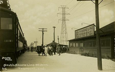 Postcard: South Shore Line Tremont Station (circa 1930) Collection of Steven S Shook at Porter County Web |
 The site of the former Tremont Station. |
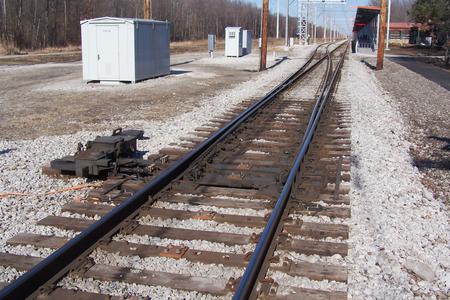
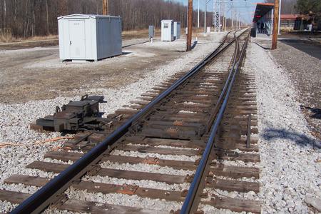
Dune Park 2009 Dune Park Station before construction of a new high level boarding platform began in 2013. |
|
|
|
|
|
|
|
|
|